| Item Detail |
| |
| |
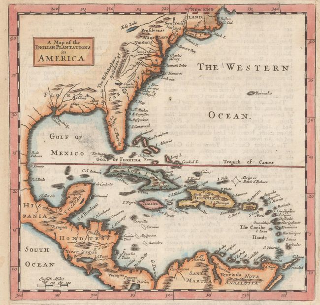
MapMaker: |
Herman Moll
|
|
| |
| |
Subject: |
Colonial Eastern North America & West Indies |
|
| |
Period/Size: |
1701 / 7.1" x 7.3" (18.1 x 18.6 cm)
|
|
| |
Color: |
Colored
|
|
| |
Condition: |
(B+) On a watermarked sheet that has been remargined at left and right to better accommodate framing. There is a 4" repaired tear in a blank space below the map image and a few faint damp stains in the margins. (condition help) |
|
| |
Source: |
A System of Geography... |
|
| |
References: |
Philipps (Atlases) #536. |
|
| |
|
|
| Sales Information |
| |
| |
Price: |
|
|
| |
| |
Offered by: |
Old World Auctions |
|
| |
Catalog: |
Auction No. 158 - Antique Maps, Charts, Atlases & Globes (9323) |
|
| |
Lot/Item #: |
70 |
|
| |
| |
Date: |
06/2016
|
|
| |
| |
|