| Item Detail |
| |
| |
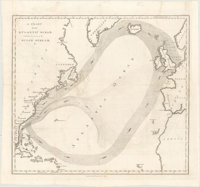
MapMaker: |
Benjamin Franklin
|
|
| |
| |
Subject: |
North Atlantic, Gulf Stream |
|
| |
Period/Size: |
1808 / 12.4" x 13.7" (31.5 x 34.8 cm)
|
|
| |
Color: |
Black & White
|
|
| |
Condition: |
(B+) Issued folding, now flat, with minor offsetting and some tiny fold separations that have been repaired on verso with archival materials. A binding trim at top right has been replaced with old paper and the associated binding tear that does not enter (condition help) |
|
| |
Source: |
Memoirs of the Life and Writings of Benjamin Franklin |
|
| |
References: |
|
|
| |
|
|
| Sales Information |
| |
| |
Price: |
|
|
| |
| |
Offered by: |
Old World Auctions |
|
| |
Catalog: |
Auction No. 158 - Antique Maps, Charts, Atlases & Globes (9323) |
|
| |
Lot/Item #: |
208 |
|
| |
| |
Date: |
06/2016
|
|
| |
| |
|