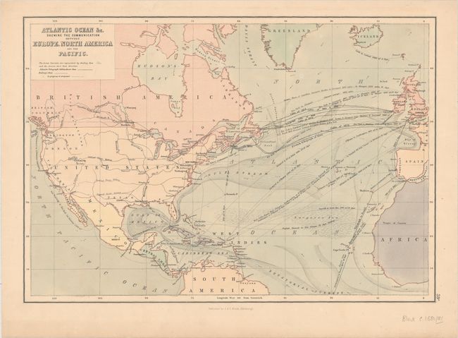
Title:
“Atlantic Ocean &c. Shewing the Communication between Europe, North America and the Pacific”
Map Maker:
Adam & Charles Black
Interesting chart that shows transatlantic telegra... (full text available to subscribers)
| Item Detail |
| |
| |
MapMaker: |
Adam & Charles Black
|
|
| |
| |
Subject: |
North Atlantic |
|
| |
Period/Size: |
1881 / 10.4" x 15.1" (26.5 x 38.4 cm)
|
|
| |
Color: |
Colored
|
|
| |
Condition: |
(A) Pleasant light toning with a few edge chips and tears closed on verso with archival tape. (condition help) |
|
| |
Source: |
|
|
| |
References: |
|
|
| |
|
|
| Sales Information |
| |
| |
Price: |
|
|
| |
| |
Offered by: |
Old World Auctions |
|
| |
Catalog: |
Auction No. 158 - Antique Maps, Charts, Atlases & Globes (9323) |
|
| |
Lot/Item #: |
211 |
|
| |
| |
Date: |
06/2016
|
|
| |
| |
|
Antique Maps - Valuation and Pricing, Descriptions, Resources |
|
Home |
Information |
Search |
Register |
Contact Us |
Site Map
Americana Exchange, Inc. © 1999 - 2024 Americana Exchange, Inc.. All rights reserved.
OldMaps.com, the OldMaps.com logo and
AMPR are service marks or registered service marks of Americana Exchange, Inc..
|