Title:
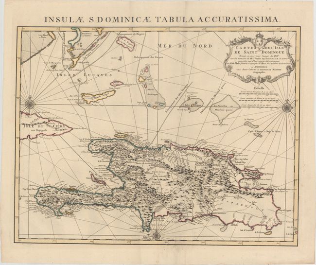
“Carte de l'Isle de Saint Domingue Dressee en 1722 pour l'Usage du Roy...”
Map Maker:
Delisle/Covens & Mortier
This is an important map of Hispaniola and the Tur... (full text available to subscribers)
| Item Detail |
| |
| |
MapMaker: |
Delisle/Covens & Mortier
|
|
| |
| |
Subject: |
Hispaniola |
|
| |
Period/Size: |
1722 / 18.4" x 23.9" (46.8 x 60.7 cm)
|
|
| |
Color: |
Colored
|
|
| |
Condition: |
(A) A dark impression on watermarked paper with original outline color. There is an extraneous crease adjacent to the centerfold and a couple short edge tears in the blank margins. (condition help) |
|
| |
Source: |
|
|
| |
References: |
|
|
| |
|
|
| Sales Information |
| |
| |
Price: |
|
|
| |
| |
Offered by: |
Old World Auctions |
|
| |
Catalog: |
Auction No. 158 - Antique Maps, Charts, Atlases & Globes (9323) |
|
| |
Lot/Item #: |
176 |
|
| |
| |
Date: |
06/2016
|
|
| |
| |
|
Antique Maps - Valuation and Pricing, Descriptions, Resources |
|
Home |
Information |
Search |
Register |
Contact Us |
Site Map
Americana Exchange, Inc. © 1999 - 2024 Americana Exchange, Inc.. All rights reserved.
OldMaps.com, the OldMaps.com logo and
AMPR are service marks or registered service marks of Americana Exchange, Inc..
|