Title:
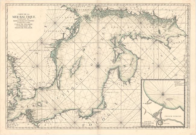
“Carte de la Mer Baltique, Contenant les Bancs, Isles et Costes Comprises Entre l'Isle de Zelande et l'Extremite du Golfe de Finlande”
Map Maker:
Herman van Loon
This superb, large sea chart of the Baltic Sea is ... (full text available to subscribers)
| Item Detail |
| |
| |
MapMaker: |
Herman van Loon
|
|
| |
| |
Subject: |
Baltic |
|
| |
Period/Size: |
1693 / 24.1" x 35.2" (61.3 x 89.4 cm)
|
|
| |
Color: |
Colored
|
|
| |
Condition: |
(A) A dark impression with original outline color on a sheet with a "B Colombier" watermark. There is a printer's crease along centerfold at top and very minor soiling. (condition help) |
|
| |
Source: |
Le Neptune Francais |
|
| |
References: |
Pastoureau, NEPTUNE FRANCAIS A [2]. |
|
| |
|
|
| Sales Information |
| |
| |
Price: |
|
|
| |
| |
Offered by: |
Old World Auctions |
|
| |
Catalog: |
Auction No. 158 - Antique Maps, Charts, Atlases & Globes (9323) |
|
| |
Lot/Item #: |
271 |
|
| |
| |
Date: |
06/2016
|
|
| |
| |
|
Antique Maps - Valuation and Pricing, Descriptions, Resources |
|
Home |
Information |
Search |
Register |
Contact Us |
Site Map
Americana Exchange, Inc. © 1999 - 2024 Americana Exchange, Inc.. All rights reserved.
OldMaps.com, the OldMaps.com logo and
AMPR are service marks or registered service marks of Americana Exchange, Inc..
|