Title:
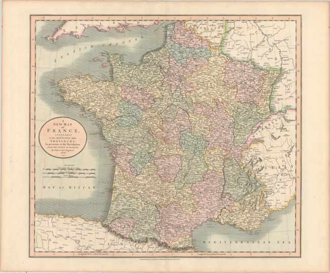
“A New Map of France, Agreeable to Its Division Into Provinces, as Previous to the Revolution from the Latest Authorities”
Map Maker:
John Cary
This densely detailed map shows provinces, towns, ... (full text available to subscribers)
| Item Detail |
| |
| |
MapMaker: |
John Cary
|
|
| |
| |
Subject: |
France |
|
| |
Period/Size: |
1806 / 18.0" x 20.3" (45.8 x 51.6 cm)
|
|
| |
Color: |
Colored
|
|
| |
Condition: |
(A) Full original color on paper watermarked "1804" and light toning along the edges of the sheet. (condition help) |
|
| |
Source: |
New Universal Atlas |
|
| |
References: |
|
|
| |
|
|
| Sales Information |
| |
| |
Price: |
|
|
| |
| |
Offered by: |
Old World Auctions |
|
| |
Catalog: |
Auction No. 158 - Antique Maps, Charts, Atlases & Globes (9323) |
|
| |
Lot/Item #: |
289 |
|
| |
| |
Date: |
06/2016
|
|
| |
| |
|
Antique Maps - Valuation and Pricing, Descriptions, Resources |
|
Home |
Information |
Search |
Register |
Contact Us |
Site Map
Americana Exchange, Inc. © 1999 - 2024 Americana Exchange, Inc.. All rights reserved.
OldMaps.com, the OldMaps.com logo and
AMPR are service marks or registered service marks of Americana Exchange, Inc..
|