Title:
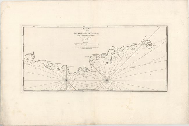
“A Chart of the South Coast of Hay-Nan from Tinhosa to Guichou...”
Map Maker:
Sayer & Bennett
This fine sea chart depicts the southern coast of ... (full text available to subscribers)
| Item Detail |
| |
| |
MapMaker: |
Sayer & Bennett
|
|
| |
| |
Subject: |
Southern China |
|
| |
Period/Size: |
1781 / 13.1" x 28.7" (33.3 x 72.9 cm)
|
|
| |
Color: |
Black & White
|
|
| |
Condition: |
(A) On a heavy sheet with very wide margins and a few tiny holes only noticeable when held to light. Faint manuscript notations are confined to the blank margins. (condition help) |
|
| |
Source: |
|
|
| |
References: |
|
|
| |
|
|
| Sales Information |
| |
| |
Price: |
|
|
| |
| |
Offered by: |
Old World Auctions |
|
| |
Catalog: |
Auction No. 158 - Antique Maps, Charts, Atlases & Globes (9323) |
|
| |
Lot/Item #: |
405 |
|
| |
| |
Date: |
06/2016
|
|
| |
| |
|
Antique Maps - Valuation and Pricing, Descriptions, Resources |
|
Home |
Information |
Search |
Register |
Contact Us |
Site Map
Americana Exchange, Inc. © 1999 - 2024 Americana Exchange, Inc.. All rights reserved.
OldMaps.com, the OldMaps.com logo and
AMPR are service marks or registered service marks of Americana Exchange, Inc..
|