Title:
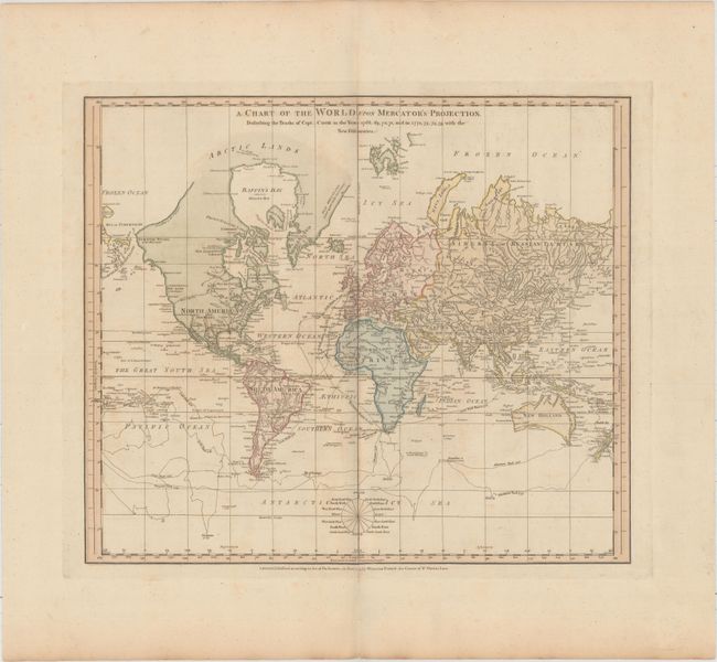
“A Chart of the World upon Mercator's Projection. Describing the Tracks of Capt. Cook in the Years 1768, 69, 70, 71, and in 1772, 73, 74, 75, with the New Discoveries”
Map Maker:
Jefferys & Faden
This interesting chart of the world presented on M... (full text available to subscribers)
| Item Detail |
| |
| |
MapMaker: |
Jefferys & Faden
|
|
| |
| |
Subject: |
World |
|
| |
Period/Size: |
1775 / 15.4" x 17.9" (39.2 x 45.5 cm)
|
|
| |
Color: |
Colored
|
|
| |
Condition: |
(B+) Full original color on watermarked paper with wide margins. Thee is mild toning, faint offsetting, and a few small spots. (condition help) |
|
| |
Source: |
Geographical Exercises; Calculated to Facilitate the Study of Geography |
|
| |
References: |
Shirley (BL Atlases) T.FAD-1a #9. |
|
| |
|
|
| Sales Information |
| |
| |
Price: |
|
|
| |
| |
Offered by: |
Old World Auctions |
|
| |
Catalog: |
Auction No. 159 - Antique Maps, Charts, Atlases & Globes (9324) |
|
| |
Lot/Item #: |
28 |
|
| |
| |
Date: |
09/2016
|
|
| |
| |
|
Antique Maps - Valuation and Pricing, Descriptions, Resources |
|
Home |
Information |
Search |
Register |
Contact Us |
Site Map
Americana Exchange, Inc. © 1999 - 2024 Americana Exchange, Inc.. All rights reserved.
OldMaps.com, the OldMaps.com logo and
AMPR are service marks or registered service marks of Americana Exchange, Inc..
|