| Item Detail |
| |
| |
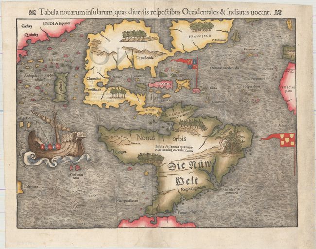
MapMaker: |
Sebastian Munster
|
|
| |
| |
Subject: |
Western Hemisphere - America |
|
| |
Period/Size: |
1550 / 10.1" x 13.5" (25.7 x 34.3 cm)
|
|
| |
Color: |
Colored
|
|
| |
Condition: |
(B+) An excellent, dark impression with light soiling and a number of tiny worm holes that have been professionally infilled. There are several creases adjacent to the centerfold that have been pressed flat, and the right margin has been extended with ol (condition help) |
|
| |
Source: |
Cosmographia |
|
| |
References: |
Burden #12, state 5; Kershaw #4a. |
|
| |
|
|
| Sales Information |
| |
| |
Price: |
|
|
| |
| |
Offered by: |
Old World Auctions |
|
| |
Catalog: |
Auction No. 159 - Antique Maps, Charts, Atlases & Globes (9324) |
|
| |
Lot/Item #: |
68 |
|
| |
| |
Date: |
09/2016
|
|
| |
| |
|