Title:
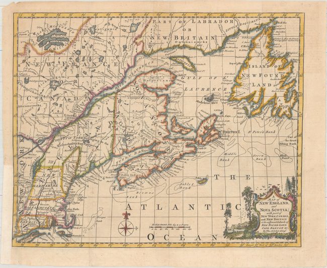
“A Map of New England, and Nova Scotia; with Part of New York, Canada, and New Britain & the Adjacent Islands of New Found Land Cape Breton &c.”
Map Maker:
Thomas Kitchin
This scarce map of eastern Canada and Newfoundland... (full text available to subscribers)
| Item Detail |
| |
| |
MapMaker: |
Thomas Kitchin
|
|
| |
| |
Subject: |
Colonial Northeastern United States & Canada |
|
| |
Period/Size: |
1758 / 10.6" x 13.0" (27.0 x 33.1 cm)
|
|
| |
Color: |
Colored
|
|
| |
Condition: |
(B+) Issued folding on watermarked paper, now flattened with a few small spots and light offsetting at top right from an opposing page of text. A binding trim at bottom left has been replaced with old paper. (condition help) |
|
| |
Source: |
London Magazine |
|
| |
References: |
Kershaw #708; Sellers & Van Ee #80; Jolly #LOND-145; McCorkle #758.7. |
|
| |
|
|
| Sales Information |
| |
| |
Price: |
|
|
| |
| |
Offered by: |
Old World Auctions |
|
| |
Catalog: |
Auction No. 159 - Antique Maps, Charts, Atlases & Globes (9324) |
|
| |
Lot/Item #: |
135 |
|
| |
| |
Date: |
09/2016
|
|
| |
| |
|
Antique Maps - Valuation and Pricing, Descriptions, Resources |
|
Home |
Information |
Search |
Register |
Contact Us |
Site Map
Americana Exchange, Inc. © 1999 - 2024 Americana Exchange, Inc.. All rights reserved.
OldMaps.com, the OldMaps.com logo and
AMPR are service marks or registered service marks of Americana Exchange, Inc..
|