Title:
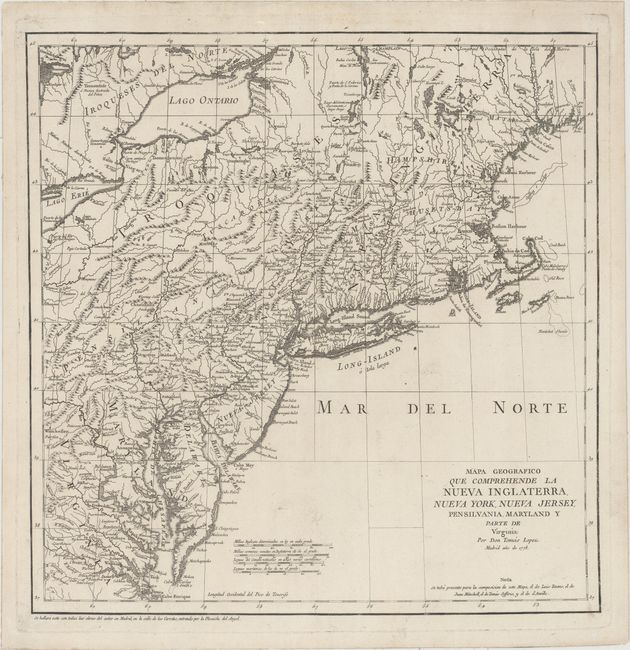
“Mapa Geografico que Comprehende la Nueva Inglaterra, Nueva York, Nueva Jersey, Pensilvania, Maryland y Parte de Virginia”
Map Maker:
Thomas Lopez y Vargas Machuca
This is one of the rare Spanish maps of the United... (full text available to subscribers)
| Item Detail |
| |
| |
MapMaker: |
Thomas Lopez y Vargas Machuca
|
|
| |
| |
Subject: |
Colonial New England - United States |
|
| |
Period/Size: |
1778 / 15.4" x 15.1" (39.2 x 38.4 cm)
|
|
| |
Color: |
Black & White
|
|
| |
Condition: |
(A) A dark impression on a sheet of watermarked paper with minor soiling. (condition help) |
|
| |
Source: |
|
|
| |
References: |
McCorkle #778.7; Shirley (BL Atlases) T.LOP-3a #2, Vol 2. |
|
| |
|
|
| Sales Information |
| |
| |
Price: |
|
|
| |
| |
Offered by: |
Old World Auctions |
|
| |
Catalog: |
Auction No. 159 - Antique Maps, Charts, Atlases & Globes (9324) |
|
| |
Lot/Item #: |
175 |
|
| |
| |
Date: |
09/2016
|
|
| |
| |
|
Antique Maps - Valuation and Pricing, Descriptions, Resources |
|
Home |
Information |
Search |
Register |
Contact Us |
Site Map
Americana Exchange, Inc. © 1999 - 2024 Americana Exchange, Inc.. All rights reserved.
OldMaps.com, the OldMaps.com logo and
AMPR are service marks or registered service marks of Americana Exchange, Inc..
|