| Item Detail |
| |
| |
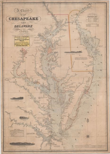
MapMaker: |
Fielding Lucas
|
|
| |
| |
Subject: |
Mid-Atlantic United States, Chesapeake & Delaware Bays |
|
| |
Period/Size: |
1852 / 40.5" x 28.3" (102.9 x 71.9 cm)
|
|
| |
Color: |
Colored
|
|
| |
Condition: |
(B+) Original color with light soiling that is more prominent in the corners. There is minor creasing and some tiny spots of foxing in the bottom corners and at top right. There are several short cracks/tears along the edges of the sheet that have been (condition help) |
|
| |
Source: |
|
|
| |
References: |
Guthorn, p. 78. |
|
| |
|
|
| Sales Information |
| |
| |
Price: |
|
|
| |
| |
Offered by: |
Old World Auctions |
|
| |
Catalog: |
Auction No. 159 - Antique Maps, Charts, Atlases & Globes (9324) |
|
| |
Lot/Item #: |
189 |
|
| |
| |
Date: |
09/2016
|
|
| |
| |
|