| Item Detail |
| |
| |
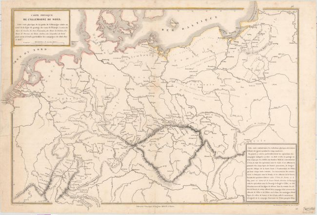
MapMaker: |
Drioux & Leroy
|
|
| |
| |
Subject: |
Central Europe, Germany |
|
| |
Period/Size: |
1860 / 12.3" x 17.4" (31.3 x 44.2 cm)
|
|
| |
Color: |
Colored
|
|
| |
Condition: |
(B+) There is light scattered foxing, a small hole by the centerfold, and some short edge tears closed on verso with cello tape, a couple of which just pass the neatline. (condition help) |
|
| |
Source: |
Atlas Universel et Classique de Geographie Ancienne, Romaine, du Moyen Age... |
|
| |
References: |
|
|
| |
|
|
| Sales Information |
| |
| |
Price: |
|
|
| |
| |
Offered by: |
Old World Auctions |
|
| |
Catalog: |
Auction No. 159 - Antique Maps, Charts, Atlases & Globes (9324) |
|
| |
Lot/Item #: |
487 |
|
| |
| |
Date: |
09/2016
|
|
| |
| |
|