Rister or Sign In to see pricing information


Title:

Carte Routiere de l'Italie Indiquant les Divisions Politiques des Divers Etats. Dressee en 1820

Map Maker:

Adrien Hubert Brue

Carte Routiere de l'Italie Indiquant les Divisions Politiques des Divers Etats. Dressee en 1820

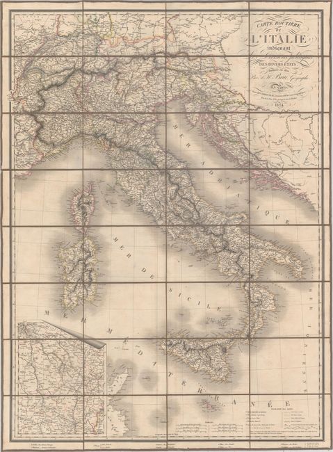
This large, handsome map of Italy includes an inse... (full text available to subscribers)
Item Detail
 
  MapMaker:  

Adrien Hubert Brue


  Subject:  Italy, Switzerland, Croatia, Slovenia, France  
  Period/Size:  1824 / 32.1" x 23.8"  (81.6 x 60.5 cm)  
  Color:  Colored  
  Condition:  (B+) Light offsetting and minor soiling. The slipcase has light wear with a small chip above the title label. (condition help)  
  Source:   
  References:   
 
 
Sales Information
 
  Price: 

Please register your email to view records, or sign in with email address to see records


  Offered by:  Old World Auctions  
  Catalog:  Auction No. 159 - Antique Maps, Charts, Atlases & Globes (9324)  
  Lot/Item #:  541  
 
  Date:  09/2016  


Antique Maps - Valuation and Pricing, Descriptions, Resources


Home | Information | Search | Register | Contact Us | Site Map

Americana Exchange, Inc. © 1999 - 2024 Americana Exchange, Inc.. All rights reserved. OldMaps.com, the OldMaps.com logo and
AMPR are service marks or registered service marks of Americana Exchange, Inc..