Title:
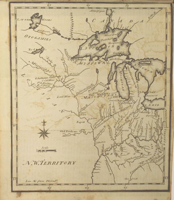
“The United States Gazetteer: Containing an Authentic Description of the Several States Their Situation, Extent, Boundaries, Soil, Produce, Climate, Population, Trade and Manufactures...”
Map Maker:
Joseph T. Scott
Joseph Scott was a Philadelphia engraver and publi... (full text available to subscribers)
| Item Detail |
| |
| |
MapMaker: |
Joseph T. Scott
|
|
| |
| |
Subject: |
Geography Books |
|
| |
Period/Size: |
1795 / 7.0" x 4.5" (17.8 x 11.5 cm)
|
|
| |
Color: |
Black & White
|
|
| |
Condition: |
(B) The majority of the maps have moderate offsetting and light foxing, although a few have only light offsetting (Delaware, New Jersey, Kentucky, Maine & New Hampshire). The map of South Carolina also has heavy soiling along one fold, and the map of Vir (condition help) |
|
| |
Source: |
|
|
| |
References: |
Howes #S237; Ristow, p. 154; Sabin #78331; Wheat & Brun #125. |
|
| |
|
|
| Sales Information |
| |
| |
Price: |
|
|
| |
| |
Offered by: |
Old World Auctions |
|
| |
Catalog: |
Auction No. 159 - Antique Maps, Charts, Atlases & Globes (9324) |
|
| |
Lot/Item #: |
756 |
|
| |
| |
Date: |
09/2016
|
|
| |
| |
|
Antique Maps - Valuation and Pricing, Descriptions, Resources |
|
Home |
Information |
Search |
Register |
Contact Us |
Site Map
Americana Exchange, Inc. © 1999 - 2024 Americana Exchange, Inc.. All rights reserved.
OldMaps.com, the OldMaps.com logo and
AMPR are service marks or registered service marks of Americana Exchange, Inc..
|