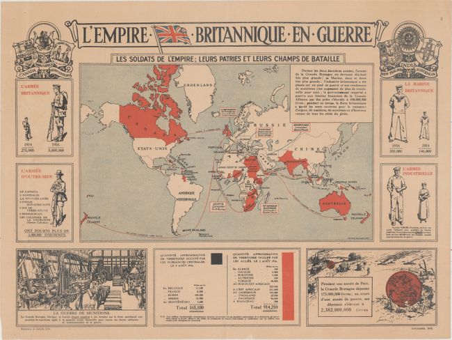
Title:
“L'Empire Britannique en Guerre”
Map Maker:
Edward Stanford
This fascinating, ephemeral piece celebrates Brita... (full text available to subscribers)
| Item Detail |
| |
| |
MapMaker: |
Edward Stanford
|
|
| |
| |
Subject: |
World, World War I |
|
| |
Period/Size: |
1916 / 13.7" x 19.1" (34.8 x 48.6 cm)
|
|
| |
Color: |
Colored
|
|
| |
Condition: |
(B+) Issued folding and now flattened with light toning and a few extraneous creases. (condition help) |
|
| |
Source: |
|
|
| |
References: |
|
|
| |
|
|
| Sales Information |
| |
| |
Price: |
|
|
| |
| |
Offered by: |
Old World Auctions |
|
| |
Catalog: |
Auction No. 160 - Antique Maps, Charts, Atlases & Globes (9325) |
|
| |
Lot/Item #: |
42 |
|
| |
| |
Date: |
11/2016
|
|
| |
| |
|
Antique Maps - Valuation and Pricing, Descriptions, Resources |
|
Home |
Information |
Search |
Register |
Contact Us |
Site Map
Americana Exchange, Inc. © 1999 - 2024 Americana Exchange, Inc.. All rights reserved.
OldMaps.com, the OldMaps.com logo and
AMPR are service marks or registered service marks of Americana Exchange, Inc..
|