| Item Detail |
| |
| |
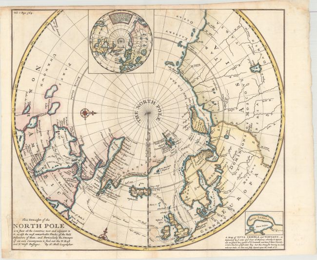
MapMaker: |
Herman Moll
|
|
| |
| |
Subject: |
North Pole |
|
| |
Period/Size: |
1705 / 14.8" x 16.8" (37.6 x 42.7 cm)
|
|
| |
Color: |
Colored
|
|
| |
Condition: |
(B) Issued folding, now flattened, on paper with a "B" watermark. There are a pair of printer's creases at top, several minor extraneous creases, some foxing, and toning along the top edge of the sheet, which has a narrow margin. A small binding trim at (condition help) |
|
| |
Source: |
Navigantum ataque Itinerantium Bibliotheca... |
|
| |
References: |
Kershaw #399. |
|
| |
|
|
| Sales Information |
| |
| |
Price: |
|
|
| |
| |
Offered by: |
Old World Auctions |
|
| |
Catalog: |
Auction No. 160 - Antique Maps, Charts, Atlases & Globes (9325) |
|
| |
Lot/Item #: |
51 |
|
| |
| |
Date: |
11/2016
|
|
| |
| |
|