| Item Detail |
| |
| |
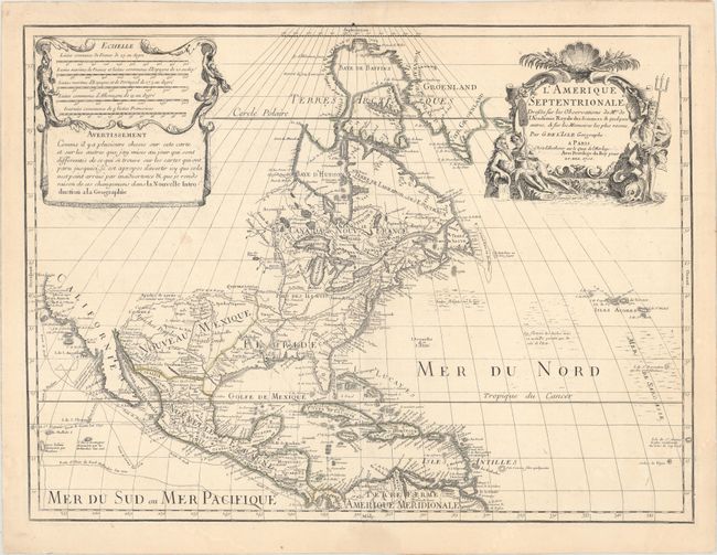
MapMaker: |
Guillaume Delisle
|
|
| |
| |
Subject: |
Colonial North America |
|
| |
Period/Size: |
1700 / 17.9" x 24.0" (45.5 x 61.0 cm)
|
|
| |
Color: |
Colored
|
|
| |
Condition: |
(B+) Watermarked paper with original outline color that has faded, light soiling, and a professionally repaired tear that enters 2" into map at bottom. There are faint damp stains in the blank margins. (condition help) |
|
| |
Source: |
|
|
| |
References: |
Mercator's World Vol. 6, No. 4, pp. 44-49; Tooley (Amer) p. 19, #30; Wheat [TMW] #79; Burden #761. |
|
| |
|
|
| Sales Information |
| |
| |
Price: |
|
|
| |
| |
Offered by: |
Old World Auctions |
|
| |
Catalog: |
Auction No. 160 - Antique Maps, Charts, Atlases & Globes (9325) |
|
| |
Lot/Item #: |
92 |
|
| |
| |
Date: |
11/2016
|
|
| |
| |
|