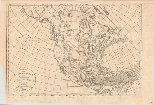
Title:
“Charte von Nord-America zur Erlauterung des Systems der Winde und Stromungen”
Map Maker:
Weimar Geographisches Institut
This is the German edition of C.F. Volney's map of... (full text available to subscribers)
| Item Detail |
| |
| |
MapMaker: |
Weimar Geographisches Institut
|
|
| |
| |
Subject: |
North America |
|
| |
Period/Size: |
1804 / 8.8" x 12.9" (22.4 x 32.8 cm)
|
|
| |
Color: |
Black & White
|
|
| |
Condition: |
(B+) Issued folding with light offsetting and a few small spots. (condition help) |
|
| |
Source: |
Allgemeine Geographische Ephemeriden |
|
| |
References: |
Howes #V141. |
|
| |
|
|
| Sales Information |
| |
| |
Price: |
|
|
| |
| |
Offered by: |
Old World Auctions |
|
| |
Catalog: |
Auction No. 160 - Antique Maps, Charts, Atlases & Globes (9325) |
|
| |
Lot/Item #: |
101 |
|
| |
| |
Date: |
11/2016
|
|
| |
| |
|
Antique Maps - Valuation and Pricing, Descriptions, Resources |
|
Home |
Information |
Search |
Register |
Contact Us |
Site Map
Americana Exchange, Inc. © 1999 - 2024 Americana Exchange, Inc.. All rights reserved.
OldMaps.com, the OldMaps.com logo and
AMPR are service marks or registered service marks of Americana Exchange, Inc..
|