| Item Detail |
| |
| |
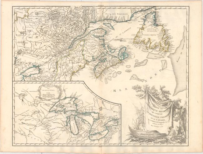
MapMaker: |
Didier Robert de Vaugondy
|
|
| |
| |
Subject: |
Colonial Northeastern United States & Canada, Great Lakes |
|
| |
Period/Size: |
1755 / 19.0" x 23.8" (48.3 x 60.5 cm)
|
|
| |
Color: |
Colored
|
|
| |
Condition: |
(B+) A crisp impression on watermarked paper with light scattered foxing, minor offsetting, and two tiny tears running parallel to the centerfold near the middle of the image. (condition help) |
|
| |
Source: |
Atlas Universel |
|
| |
References: |
Kershaw #356; Pedley #459; Karpinski p.141-42; McCorckle #755.36. |
|
| |
|
|
| Sales Information |
| |
| |
Price: |
|
|
| |
| |
Offered by: |
Old World Auctions |
|
| |
Catalog: |
Auction No. 160 - Antique Maps, Charts, Atlases & Globes (9325) |
|
| |
Lot/Item #: |
135 |
|
| |
| |
Date: |
11/2016
|
|
| |
| |
|