| Item Detail |
| |
| |
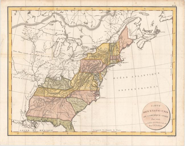
MapMaker: |
Constantin Francois de Chasseborcy de Volney
|
|
| |
| |
Subject: |
Eastern United States & Canada |
|
| |
Period/Size: |
1803 / 17.1" x 22.2" (43.5 x 56.4 cm)
|
|
| |
Color: |
Colored
|
|
| |
Condition: |
(A) A crisp impression issued folding on watermarked paper with faint offsetting, a hint of toning along a fold at left, and minor scattered foxing that is mostly confined to the blank margins. There are some short fold separations in the blank margins t (condition help) |
|
| |
Source: |
|
|
| |
References: |
|
|
| |
|
|
| Sales Information |
| |
| |
Price: |
|
|
| |
| |
Offered by: |
Old World Auctions |
|
| |
Catalog: |
Auction No. 160 - Antique Maps, Charts, Atlases & Globes (9325) |
|
| |
Lot/Item #: |
151 |
|
| |
| |
Date: |
11/2016
|
|
| |
| |
|