| Item Detail |
| |
| |
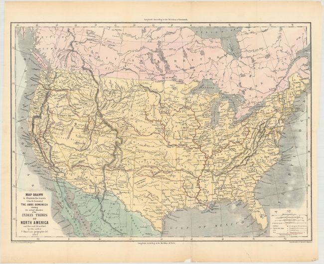
MapMaker: |
P. Bineteau
|
|
| |
| |
Subject: |
United States |
|
| |
Period/Size: |
1860 / 13.3" x 18.0" (33.8 x 45.8 cm)
|
|
| |
Color: |
Colored
|
|
| |
Condition: |
(A) Issued folding and now flattened and backed with tissue. There is a short fold separation confined to the bottom blank margin and a minor chip. (condition help) |
|
| |
Source: |
Seven Years Residence in the Great Desserts of North America |
|
| |
References: |
|
|
| |
|
|
| Sales Information |
| |
| |
Price: |
|
|
| |
| |
Offered by: |
Old World Auctions |
|
| |
Catalog: |
Auction No. 160 - Antique Maps, Charts, Atlases & Globes (9325) |
|
| |
Lot/Item #: |
163 |
|
| |
| |
Date: |
11/2016
|
|
| |
| |
|