| Item Detail |
| |
| |
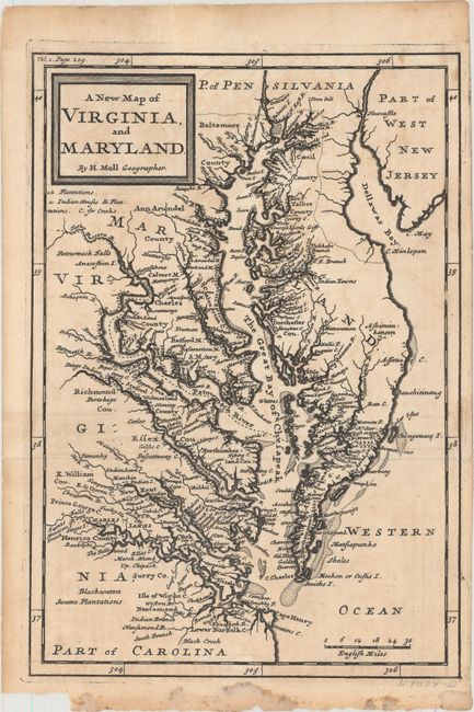
MapMaker: |
Herman Moll
|
|
| |
| |
Subject: |
Colonial Mid-Atlantic United States |
|
| |
Period/Size: |
1708 / 10.1" x 7.1" (25.7 x 18.1 cm)
|
|
| |
Color: |
Black & White
|
|
| |
Condition: |
(B+) A dark impression, issued folding and now pressed with minor offsetting and faint staining. There is a chip at bottom left, away from image. (condition help) |
|
| |
Source: |
The British Empire in America... |
|
| |
References: |
Shirley (BL Atlases) G.OLD-1a #4; cf. Stephenson & McKee #II-16; Wooldridge #85. |
|
| |
|
|
| Sales Information |
| |
| |
Price: |
|
|
| |
| |
Offered by: |
Old World Auctions |
|
| |
Catalog: |
Auction No. 160 - Antique Maps, Charts, Atlases & Globes (9325) |
|
| |
Lot/Item #: |
195 |
|
| |
| |
Date: |
11/2016
|
|
| |
| |
|