Title:
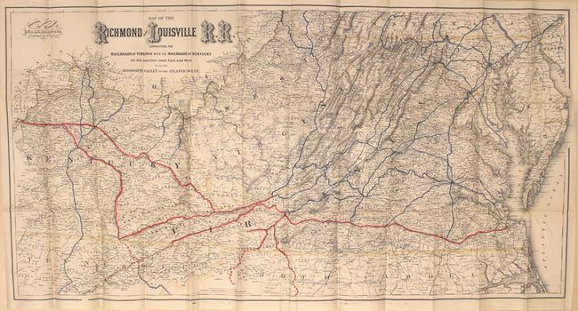
“Map of the Richmond and Louisville R.R. Connecting the Railroads of Virginia with the Railroads of Kentucky...”
Map Maker:
G.W. & C.B Colton [& Co.]
This large and very detailed map delineates the ma... (full text available to subscribers)
| Item Detail |
| |
| |
MapMaker: |
G.W. & C.B Colton [& Co.]
|
|
| |
| |
Subject: |
Southern United States |
|
| |
Period/Size: |
1882 / 25.0" x 50.0" (63.5 x 127.0 cm)
|
|
| |
Color: |
Colored
|
|
| |
Condition: |
(A) A clean and bright example with just a few tiny splits at fold intersections, else fine. Cardboard wrappers have minor soiling. (condition help) |
|
| |
Source: |
|
|
| |
References: |
Modelski #546; Phillips (Maps) p. 749. |
|
| |
|
|
| Sales Information |
| |
| |
Price: |
|
|
| |
| |
Offered by: |
Old World Auctions |
|
| |
Catalog: |
Auction No. 160 - Antique Maps, Charts, Atlases & Globes (9325) |
|
| |
Lot/Item #: |
217 |
|
| |
| |
Date: |
11/2016
|
|
| |
| |
|
Antique Maps - Valuation and Pricing, Descriptions, Resources |
|
Home |
Information |
Search |
Register |
Contact Us |
Site Map
Americana Exchange, Inc. © 1999 - 2024 Americana Exchange, Inc.. All rights reserved.
OldMaps.com, the OldMaps.com logo and
AMPR are service marks or registered service marks of Americana Exchange, Inc..
|