| Item Detail |
| |
| |
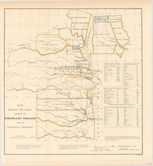
MapMaker: |
U.S. War Department
|
|
| |
| |
Subject: |
Central United States |
|
| |
Period/Size: |
1860 / 18.7" x 17.9" (47.5 x 45.5 cm)
|
|
| |
Color: |
Colored
|
|
| |
Condition: |
(B+) Issued folding and now flattened and backed with tissue. Faint offsetting and light toning confined to the top blank margin. (condition help) |
|
| |
Source: |
ASP Military Affairs, Vol. VI, No 654-A |
|
| |
References: |
cf. Claussen & Friis #127; cf. Wagner-Camp #63; cf. Wheat (TMW) #412. |
|
| |
|
|
| Sales Information |
| |
| |
Price: |
|
|
| |
| |
Offered by: |
Old World Auctions |
|
| |
Catalog: |
Auction No. 160 - Antique Maps, Charts, Atlases & Globes (9325) |
|
| |
Lot/Item #: |
223 |
|
| |
| |
Date: |
11/2016
|
|
| |
| |
|