| Item Detail |
| |
| |
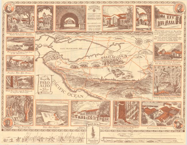
MapMaker: |
Infrequent Publ. - Local & State Maps
|
|
| |
| |
Subject: |
Northern California, Palo Alto |
|
| |
Period/Size: |
1940 / 16.9" x 21.8" (43.0 x 55.4 cm)
|
|
| |
Color: |
Colored
|
|
| |
Condition: |
(A) A near fine example, issued folding. One panel of the verso has remnants of a scrapbook page to which this was apparently affixed. (condition help) |
|
| |
Source: |
|
|
| |
References: |
|
|
| |
|
|
| Sales Information |
| |
| |
Price: |
|
|
| |
| |
Offered by: |
Old World Auctions |
|
| |
Catalog: |
Auction No. 160 - Antique Maps, Charts, Atlases & Globes (9325) |
|
| |
Lot/Item #: |
249 |
|
| |
| |
Date: |
11/2016
|
|
| |
| |
|