Title:
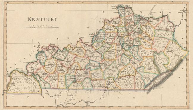
“Geographisch-Statistische und Historische Charte von Kentucky”
Map Maker:
Weimar Geographisches Institut
This is an uncommon German edition of Carey & Lea'... (full text available to subscribers)
| Item Detail |
| |
| |
MapMaker: |
Weimar Geographisches Institut
|
|
| |
| |
Subject: |
Kentucky |
|
| |
Period/Size: |
1826 / 10.5" x 18.3" (26.7 x 46.5 cm)
|
|
| |
Color: |
Colored
|
|
| |
Condition: |
(A) A nice impression on a clean sheet with a bit of faint offsetting, else fine. (condition help) |
|
| |
Source: |
|
|
| |
References: |
Phillips (A) #1225-19. |
|
| |
|
|
| Sales Information |
| |
| |
Price: |
|
|
| |
| |
Offered by: |
Old World Auctions |
|
| |
Catalog: |
Auction No. 160 - Antique Maps, Charts, Atlases & Globes (9325) |
|
| |
Lot/Item #: |
288 |
|
| |
| |
Date: |
11/2016
|
|
| |
| |
|
Antique Maps - Valuation and Pricing, Descriptions, Resources |
|
Home |
Information |
Search |
Register |
Contact Us |
Site Map
Americana Exchange, Inc. © 1999 - 2024 Americana Exchange, Inc.. All rights reserved.
OldMaps.com, the OldMaps.com logo and
AMPR are service marks or registered service marks of Americana Exchange, Inc..
|