Title:
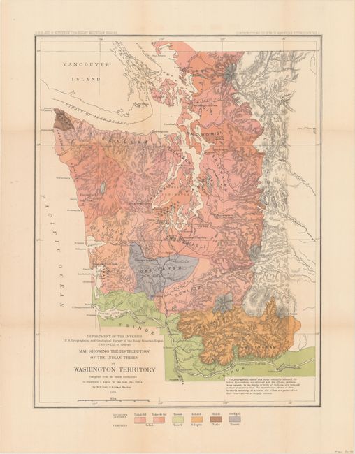
“Map Showing the Distribution of the Indian Tribes of Washington Territory Compiled from the Latest Authorities...”
Map Maker:
U.S. Department of Interior
Compiled by W.H. Dall, U.S. Coast Survey, from the... (full text available to subscribers)
| Item Detail |
| |
| |
MapMaker: |
U.S. Department of Interior
|
|
| |
| |
Subject: |
Washington |
|
| |
Period/Size: |
1876 / 20.0" x 15.5" (50.8 x 39.4 cm)
|
|
| |
Color: |
Colored
|
|
| |
Condition: |
(B+) Issued folding with light toning, minor color offsetting, and a few tiny splits at fold intersections. (condition help) |
|
| |
Source: |
Contributions to Ethnology, Vol. I |
|
| |
References: |
|
|
| |
|
|
| Sales Information |
| |
| |
Price: |
|
|
| |
| |
Offered by: |
Old World Auctions |
|
| |
Catalog: |
Auction No. 160 - Antique Maps, Charts, Atlases & Globes (9325) |
|
| |
Lot/Item #: |
341 |
|
| |
| |
Date: |
11/2016
|
|
| |
| |
|
Antique Maps - Valuation and Pricing, Descriptions, Resources |
|
Home |
Information |
Search |
Register |
Contact Us |
Site Map
Americana Exchange, Inc. © 1999 - 2024 Americana Exchange, Inc.. All rights reserved.
OldMaps.com, the OldMaps.com logo and
AMPR are service marks or registered service marks of Americana Exchange, Inc..
|