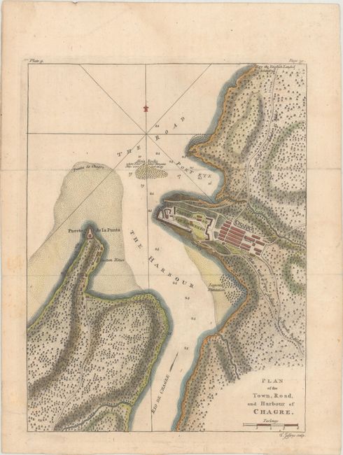
Title:
“Plan of the Town, Road, and Harbour of Chagre”
Map Maker:
Thomas Jefferys
This map depicts a bird's-eye plan of the town and... (full text available to subscribers)
| Item Detail |
| |
| |
MapMaker: |
Thomas Jefferys
|
|
| |
| |
Subject: |
Chagres, Panama |
|
| |
Period/Size: |
1762 / 10.3" x 7.9" (26.2 x 20.1 cm)
|
|
| |
Color: |
Colored
|
|
| |
Condition: |
(B+) Issued folding, now flattened on paper with a Lily watermark and light soiling. (condition help) |
|
| |
Source: |
A Description of the Spanish Islands and Settlements on the Coast of the West In |
|
| |
References: |
Kapp (MCC-73) #78-2; Shirley (BL Atlases) M.JEF-3a #9. |
|
| |
|
|
| Sales Information |
| |
| |
Price: |
|
|
| |
| |
Offered by: |
Old World Auctions |
|
| |
Catalog: |
Auction No. 160 - Antique Maps, Charts, Atlases & Globes (9325) |
|
| |
Lot/Item #: |
372 |
|
| |
| |
Date: |
11/2016
|
|
| |
| |
|
Antique Maps - Valuation and Pricing, Descriptions, Resources |
|
Home |
Information |
Search |
Register |
Contact Us |
Site Map
Americana Exchange, Inc. © 1999 - 2024 Americana Exchange, Inc.. All rights reserved.
OldMaps.com, the OldMaps.com logo and
AMPR are service marks or registered service marks of Americana Exchange, Inc..
|