| Item Detail |
| |
| |
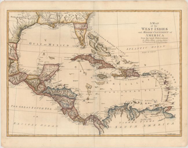
MapMaker: |
John Blair
|
|
| |
| |
Subject: |
Gulf of Mexico & Caribbean |
|
| |
Period/Size: |
1768 / 16.3" x 22.7" (41.4 x 57.7 cm)
|
|
| |
Color: |
Colored
|
|
| |
Condition: |
(A) A crisp impression on hand laid paper with a "J. Whatman" watermark with a hint of soiling along the centerfold. (condition help) |
|
| |
Source: |
The Chronology and History of the World from the Creation to the Year of Christ, |
|
| |
References: |
Shirley (BL Atlases) G.BLAI-1a #14. |
|
| |
|
|
| Sales Information |
| |
| |
Price: |
|
|
| |
| |
Offered by: |
Old World Auctions |
|
| |
Catalog: |
Auction No. 160 - Antique Maps, Charts, Atlases & Globes (9325) |
|
| |
Lot/Item #: |
382 |
|
| |
| |
Date: |
11/2016
|
|
| |
| |
|