| Item Detail |
| |
| |
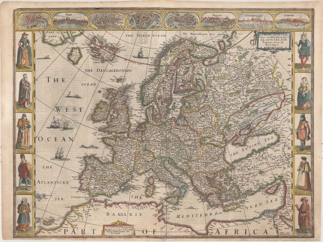
MapMaker: |
John Speed
|
|
| |
| |
Subject: |
Europe |
|
| |
Period/Size: |
1626 / 15.6" x 20.3" (39.7 x 51.6 cm)
|
|
| |
Color: |
Colored
|
|
| |
Condition: |
(B+) Watermarked paper with minor soiling, light show-through of text on verso, and a few printer's creases in the vignettes at top. There are professionally repaired centerfold separations that enter image less than 1/2" at top and 3" at bottom. (condition help) |
|
| |
Source: |
A Prospect of the Most Famous Parts of the World |
|
| |
References: |
Shirley (BL Atlases) T.SPE-2d. |
|
| |
|
|
| Sales Information |
| |
| |
Price: |
|
|
| |
| |
Offered by: |
Old World Auctions |
|
| |
Catalog: |
Auction No. 160 - Antique Maps, Charts, Atlases & Globes (9325) |
|
| |
Lot/Item #: |
464 |
|
| |
| |
Date: |
11/2016
|
|
| |
| |
|