| Item Detail |
| |
| |
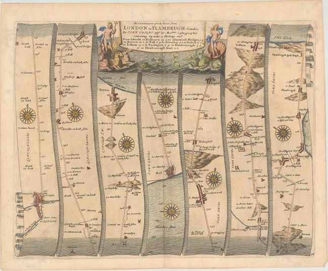
MapMaker: |
John Ogilby
|
|
| |
| |
Subject: |
Eastern England |
|
| |
Period/Size: |
1698 / 13.9" x 17.7" (35.3 x 45.0 cm)
|
|
| |
Color: |
Colored
|
|
| |
Condition: |
(B+) Light toning and soiling on paper with a fleur-de-lis watermark. There is a small stain in top blank margin. (condition help) |
|
| |
Source: |
Britannia |
|
| |
References: |
Moorland & Bannister, pp. 157-8; Shirley (BL Atlases) T.OGIL-4a #42. |
|
| |
|
|
| Sales Information |
| |
| |
Price: |
|
|
| |
| |
Offered by: |
Old World Auctions |
|
| |
Catalog: |
Auction No. 160 - Antique Maps, Charts, Atlases & Globes (9325) |
|
| |
Lot/Item #: |
483 |
|
| |
| |
Date: |
11/2016
|
|
| |
| |
|