| Item Detail |
| |
| |
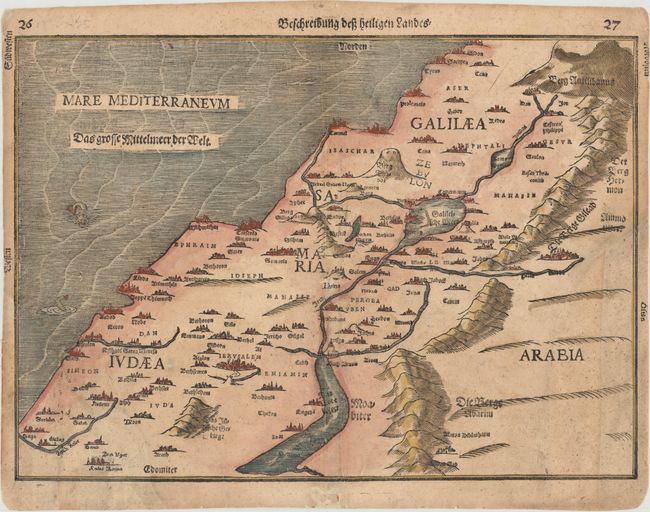
MapMaker: |
Heinrich Bunting
|
|
| |
| |
Subject: |
Holy Land |
|
| |
Period/Size: |
1600 / 10.6" x 14.8" (27.0 x 37.6 cm)
|
|
| |
Color: |
Colored
|
|
| |
Condition: |
(C+) Two large chips in bottom corners have been replaced with period-correct paper with the image skillfully replaced in facsimile. The triangular chip at bottom left measure 4" high and 3" wide, and the chip at bottom right measures 5.5" high and 2" wi (condition help) |
|
| |
Source: |
Itinerarium Sacrae Scripturae |
|
| |
References: |
Laor #141. |
|
| |
|
|
| Sales Information |
| |
| |
Price: |
|
|
| |
| |
Offered by: |
Old World Auctions |
|
| |
Catalog: |
Auction No. 160 - Antique Maps, Charts, Atlases & Globes (9325) |
|
| |
Lot/Item #: |
655 |
|
| |
| |
Date: |
11/2016
|
|
| |
| |
|