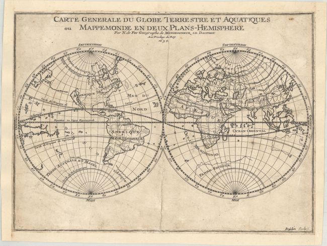
Title:
“Carte Generale du Globe Terrestre et Aquatiques ou Mappemonde en Deux Plans-Hemisphere”
Map Maker:
Nicolas de Fer
This simple double hemisphere world map presents <... (full text available to subscribers)
| Item Detail |
| |
| |
MapMaker: |
Nicolas de Fer
|
|
| |
| |
Subject: |
World |
|
| |
Period/Size: |
1695 / 8.2" x 11.2" (20.9 x 28.5 cm)
|
|
| |
Color: |
Black & White
|
|
| |
Condition: |
(B) The map is lightly soiled and trimmed to just outside the neatlines and remargined with heavier paper. Backed with Japanese tissue to repair centerfold separations at top and bottom. (condition help) |
|
| |
Source: |
Petite et Nouveau Atlas |
|
| |
References: |
Shirley #567. |
|
| |
|
|
| Sales Information |
| |
| |
Price: |
|
|
| |
| |
Offered by: |
Old World Auctions |
|
| |
Catalog: |
Auction No. 161 - Antique Maps, Charts, Atlases & Globes (9343) |
|
| |
Lot/Item #: |
12 |
|
| |
| |
Date: |
02/2017
|
|
| |
| |
|
Antique Maps - Valuation and Pricing, Descriptions, Resources |
|
Home |
Information |
Search |
Register |
Contact Us |
Site Map
Americana Exchange, Inc. © 1999 - 2024 Americana Exchange, Inc.. All rights reserved.
OldMaps.com, the OldMaps.com logo and
AMPR are service marks or registered service marks of Americana Exchange, Inc..
|