Title:
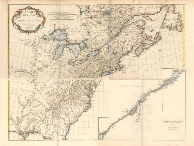
“Canada Louisiane et Terres Angloises”
Map Maker:
Jean Baptiste Bourguignon d' Anville
This large-scale map covers the region from Labrad... (full text available to subscribers)
| Item Detail |
| |
| |
MapMaker: |
Jean Baptiste Bourguignon d' Anville
|
|
| |
| |
Subject: |
Colonial Eastern United States & Canada |
|
| |
Period/Size: |
1755 / 18.8" x 44.5" (47.8 x 113.1 cm)
|
|
| |
Color: |
Colored
|
|
| |
Condition: |
(B+) A crisp impression on watermarked paper with faint offsetting and scattered foxing that is primarily in the blank margins. There is a small tear along the right border of the top joined sheet as well as a few edge tears at top that have been closed (condition help) |
|
| |
Source: |
Atlas General |
|
| |
References: |
Sellers & Van Ee #17; Cumming (SE) #296; Tooley (Amer) p. 316. |
|
| |
|
|
| Sales Information |
| |
| |
Price: |
|
|
| |
| |
Offered by: |
Old World Auctions |
|
| |
Catalog: |
Auction No. 161 - Antique Maps, Charts, Atlases & Globes (9343) |
|
| |
Lot/Item #: |
132 |
|
| |
| |
Date: |
02/2017
|
|
| |
| |
|
Antique Maps - Valuation and Pricing, Descriptions, Resources |
|
Home |
Information |
Search |
Register |
Contact Us |
Site Map
Americana Exchange, Inc. © 1999 - 2024 Americana Exchange, Inc.. All rights reserved.
OldMaps.com, the OldMaps.com logo and
AMPR are service marks or registered service marks of Americana Exchange, Inc..
|