| Item Detail |
| |
| |
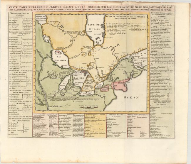
MapMaker: |
Henry Abraham Chatelain
|
|
| |
| |
Subject: |
Colonial Northeastern United States & Canada, Great Lakes |
|
| |
Period/Size: |
1719 / 14.4" x 17.9" (36.6 x 45.5 cm)
|
|
| |
Color: |
Colored
|
|
| |
Condition: |
(A) A crisp impression, issued folding, on a clean and bright sheet with a Strasbourg bend and lily watermark. There is some extraneous creasing along the right-hand fold at top, and minor foxing confined to the bottom edge of the sheet. (condition help) |
|
| |
Source: |
Atlas Historique... |
|
| |
References: |
Kershaw #307. |
|
| |
|
|
| Sales Information |
| |
| |
Price: |
|
|
| |
| |
Offered by: |
Old World Auctions |
|
| |
Catalog: |
Auction No. 161 - Antique Maps, Charts, Atlases & Globes (9343) |
|
| |
Lot/Item #: |
142 |
|
| |
| |
Date: |
02/2017
|
|
| |
| |
|