Title:
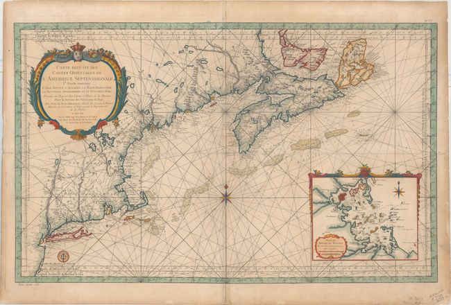
“Carte Reduite des Costes Orientales de l'Amerique Septentrionale 1re. Feuille Contenant l'Isle Royale, l'Accadie, la Bay Francoise, la Nouvelle Angleterre et la Nouvelle Yorc...”
Map Maker:
Jacques Nicolas Bellin
Scarce early issue of this superb large chart of t... (full text available to subscribers)
| Item Detail |
| |
| |
MapMaker: |
Jacques Nicolas Bellin
|
|
| |
| |
Subject: |
Colonial Northeastern United States & Canada |
|
| |
Period/Size: |
1757 / 21.6" x 34.9" (54.9 x 88.7 cm)
|
|
| |
Color: |
Colored
|
|
| |
Condition: |
(B) A dark impression on a sturdy sheet with light toning and numerous centerfold separations that have been closed on verso with tissue. A 5" tear perpendicular to the centerfold has also been archivally repaired. (condition help) |
|
| |
Source: |
Hydrographie Francoise |
|
| |
References: |
McCorkle #757.2. |
|
| |
|
|
| Sales Information |
| |
| |
Price: |
|
|
| |
| |
Offered by: |
Old World Auctions |
|
| |
Catalog: |
Auction No. 161 - Antique Maps, Charts, Atlases & Globes (9343) |
|
| |
Lot/Item #: |
145 |
|
| |
| |
Date: |
02/2017
|
|
| |
| |
|
Antique Maps - Valuation and Pricing, Descriptions, Resources |
|
Home |
Information |
Search |
Register |
Contact Us |
Site Map
Americana Exchange, Inc. © 1999 - 2024 Americana Exchange, Inc.. All rights reserved.
OldMaps.com, the OldMaps.com logo and
AMPR are service marks or registered service marks of Americana Exchange, Inc..
|