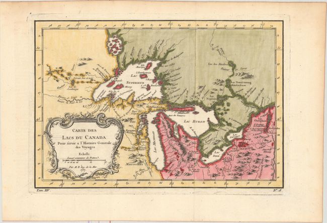
Title:
“Carte des Lacs du Canada pour Servir a l'Histoire Generale des Voyages”
Map Maker:
Jacques Nicolas Bellin
This is an excellent French & Indian War pe... (full text available to subscribers)
| Item Detail |
| |
| |
MapMaker: |
Jacques Nicolas Bellin
|
|
| |
| |
Subject: |
Colonial Great Lakes |
|
| |
Period/Size: |
1757 / 7.8" x 11.5" (19.9 x 29.3 cm)
|
|
| |
Color: |
Colored
|
|
| |
Condition: |
(A) A dark impression on watermarked paper with a bit of toning along the top edge of the sheet. (condition help) |
|
| |
Source: |
Prevost's Histoire Generale des Voyages |
|
| |
References: |
Kershaw #953; cf. Tooley (MCC-96) #871; Portinaro & Knirsch #CXXVI. |
|
| |
|
|
| Sales Information |
| |
| |
Price: |
|
|
| |
| |
Offered by: |
Old World Auctions |
|
| |
Catalog: |
Auction No. 161 - Antique Maps, Charts, Atlases & Globes (9343) |
|
| |
Lot/Item #: |
147 |
|
| |
| |
Date: |
02/2017
|
|
| |
| |
|
Antique Maps - Valuation and Pricing, Descriptions, Resources |
|
Home |
Information |
Search |
Register |
Contact Us |
Site Map
Americana Exchange, Inc. © 1999 - 2024 Americana Exchange, Inc.. All rights reserved.
OldMaps.com, the OldMaps.com logo and
AMPR are service marks or registered service marks of Americana Exchange, Inc..
|