Title:
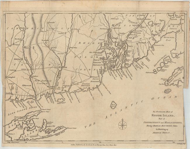
“An Accurate Map of Rhode Island, Part of Connecticut and Massachusets, Shewing Admiral Arbuthnot's Station in Blocking up Admiral Ternay”
Map Maker:
John Lodge
An uncommon, Revolutionary War era map show... (full text available to subscribers)
| Item Detail |
| |
| |
MapMaker: |
John Lodge
|
|
| |
| |
Subject: |
Colonial New England |
|
| |
Period/Size: |
1780 / 10.5" x 14.8" (26.7 x 37.6 cm)
|
|
| |
Color: |
Black & White
|
|
| |
Condition: |
(B+) Issued folding on watermarked paper with faint offsetting and a 1" binding trim at right that has been closed on verso with archival tape. Narrow side margins at bottom. (condition help) |
|
| |
Source: |
Political Magazine |
|
| |
References: |
Jolly #POL-15; McCorkle #780.8. |
|
| |
|
|
| Sales Information |
| |
| |
Price: |
|
|
| |
| |
Offered by: |
Old World Auctions |
|
| |
Catalog: |
Auction No. 161 - Antique Maps, Charts, Atlases & Globes (9343) |
|
| |
Lot/Item #: |
180 |
|
| |
| |
Date: |
02/2017
|
|
| |
| |
|
Antique Maps - Valuation and Pricing, Descriptions, Resources |
|
Home |
Information |
Search |
Register |
Contact Us |
Site Map
Americana Exchange, Inc. © 1999 - 2024 Americana Exchange, Inc.. All rights reserved.
OldMaps.com, the OldMaps.com logo and
AMPR are service marks or registered service marks of Americana Exchange, Inc..
|