| Item Detail |
| |
| |
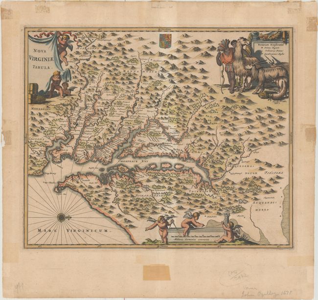
MapMaker: |
Montanus/Ogilby
|
|
| |
| |
Subject: |
Colonial Mid-Atlantic United States |
|
| |
Period/Size: |
1671 / 11.4" x 13.9" (29.0 x 35.3 cm)
|
|
| |
Color: |
Colored
|
|
| |
Condition: |
(B+) A nice impression with light toning and a couple of soft creases. There are remnants of non-archival tape both on recto and on verso that had been used to frame the map, most of which is well away from the map image with the exception of one small p (condition help) |
|
| |
Source: |
America... |
|
| |
References: |
Burden #412; Tooley (Amer) p.168-9, plt. 76; Goss (NA) #38. |
|
| |
|
|
| Sales Information |
| |
| |
Price: |
|
|
| |
| |
Offered by: |
Old World Auctions |
|
| |
Catalog: |
Auction No. 161 - Antique Maps, Charts, Atlases & Globes (9343) |
|
| |
Lot/Item #: |
184 |
|
| |
| |
Date: |
02/2017
|
|
| |
| |
|