| Item Detail |
| |
| |
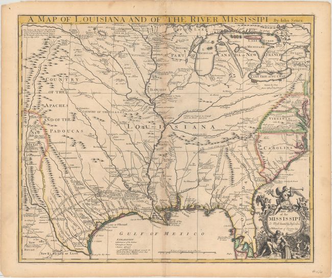
MapMaker: |
John Senex
|
|
| |
| |
Subject: |
Colonial South Central United States, Louisiana |
|
| |
Period/Size: |
1721 / 19.2" x 22.8" (48.8 x 58.0 cm)
|
|
| |
Color: |
Colored
|
|
| |
Condition: |
(B+) A crisp impression with original outline color and light toning along the centerfold and edges of the sheet. There are a few minor edge tears that are well away from the image. (condition help) |
|
| |
Source: |
New General Atlas |
|
| |
References: |
Cumming (SE) #182; Lemmon, Magill & Wiese plt. 21; Wheat (TMW) #100. |
|
| |
|
|
| Sales Information |
| |
| |
Price: |
|
|
| |
| |
Offered by: |
Old World Auctions |
|
| |
Catalog: |
Auction No. 161 - Antique Maps, Charts, Atlases & Globes (9343) |
|
| |
Lot/Item #: |
228 |
|
| |
| |
Date: |
02/2017
|
|
| |
| |
|