|
|
||
Title:
“Map of the Seat of War in Florida Compiled by Order of Bvt. Brigr. Genl. Z. Taylor, Principally from the Surveys and Reconnaissances of the Officers of the U.S. Army”
Map Maker:
U.S. War Department
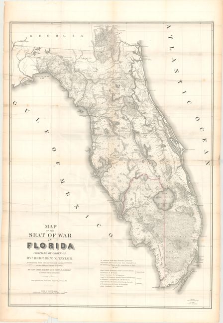
This large, remarkable map of Florida at the time ... (full text available to subscribers)
|
|
|||||||||||||||||||||||||||||||||||||||||||||||||||||||||||||||||||||||||||||||||||||||||
Antique Maps - Valuation and Pricing, Descriptions, Resources | ||||||||||||||||||||||||||||||||||||||||||||||||||||||||||||||||||||||||||||||||||||||||||
|
Home |
Information |
Search |
Register |
Contact Us |
Site Map
Americana Exchange, Inc. © 1999 - 2024 Americana Exchange, Inc.. All rights reserved.
OldMaps.com, the OldMaps.com logo and |