| Item Detail |
| |
| |
MapMaker: |
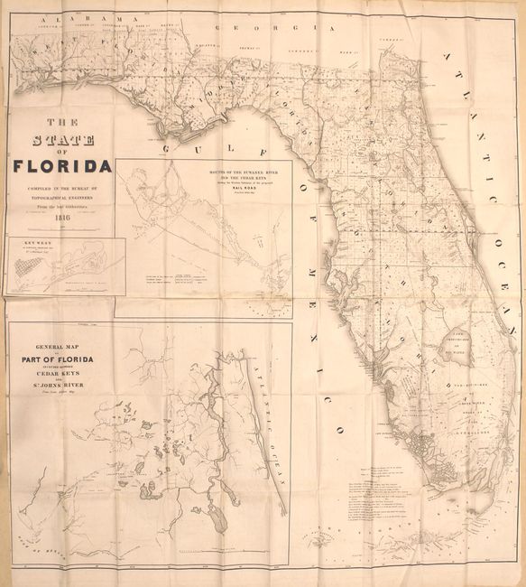
U.S. War Department
|
|
| |
| |
Subject: |
Florida |
|
| |
Period/Size: |
1846 / 42.0" x 39.5" (106.7 x 100.4 cm)
|
|
| |
Color: |
Black & White
|
|
| |
Condition: |
(B+) Issued folding with a few tiny splits at fold intersections and light, scattered foxing. There is light toning along the joint, which has become loose in several places. Narrow side margins, as issued. (condition help) |
|
| |
Source: |
|
|
| |
References: |
Phillips (Maps) p. 284. |
|
| |
|
|
| Sales Information |
| |
| |
Price: |
|
|
| |
| |
Offered by: |
Old World Auctions |
|
| |
Catalog: |
Auction No. 161 - Antique Maps, Charts, Atlases & Globes (9343) |
|
| |
Lot/Item #: |
284 |
|
| |
| |
Date: |
02/2017
|
|
| |
| |
|