Title:
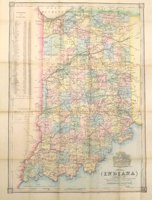
“A New Map of Indiana Exhibiting the Counties, Townships, Cities, Villages, and Post Offices Rail Roads, Canals, and Common Roads”
Map Maker:
Mendenhall
An attractive, uncommon map of the state showing c... (full text available to subscribers)
| Item Detail |
| |
| |
MapMaker: |
Mendenhall
|
|
| |
| |
Subject: |
Indiana |
|
| |
Period/Size: |
1865 / 19.4" x 14.0" (49.3 x 35.6 cm)
|
|
| |
Color: |
Colored
|
|
| |
Condition: |
(B+) Issued folding with a few minor fold separations and adjacent small tears that have been closed on verso with archival material near where the map is adhered to the back cover. Light staining along the left border where the map was glued to the boar (condition help) |
|
| |
Source: |
|
|
| |
References: |
|
|
| |
|
|
| Sales Information |
| |
| |
Price: |
|
|
| |
| |
Offered by: |
Old World Auctions |
|
| |
Catalog: |
Auction No. 161 - Antique Maps, Charts, Atlases & Globes (9343) |
|
| |
Lot/Item #: |
302 |
|
| |
| |
Date: |
02/2017
|
|
| |
| |
|
Antique Maps - Valuation and Pricing, Descriptions, Resources |
|
Home |
Information |
Search |
Register |
Contact Us |
Site Map
Americana Exchange, Inc. © 1999 - 2024 Americana Exchange, Inc.. All rights reserved.
OldMaps.com, the OldMaps.com logo and
AMPR are service marks or registered service marks of Americana Exchange, Inc..
|