Title:
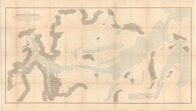
“Plan of Part of Boston Harbor Showing Improvements Made in Its Channels, by the United States and Commonwealth of Massachusetts...”
Map Maker:
U.S. Government
This large plan of Boston Harbor and its surroundi... (full text available to subscribers)
| Item Detail |
| |
| |
MapMaker: |
U.S. Government
|
|
| |
| |
Subject: |
Massachusetts |
|
| |
Period/Size: |
1883 / 28.6" x 54.9" (72.7 x 139.5 cm)
|
|
| |
Color: |
Colored
|
|
| |
Condition: |
(B+) Issued folding with light scattered foxing, some short splits at fold intersections, and light offsetting of the title. (condition help) |
|
| |
Source: |
|
|
| |
References: |
|
|
| |
|
|
| Sales Information |
| |
| |
Price: |
|
|
| |
| |
Offered by: |
Old World Auctions |
|
| |
Catalog: |
Auction No. 161 - Antique Maps, Charts, Atlases & Globes (9343) |
|
| |
Lot/Item #: |
317 |
|
| |
| |
Date: |
02/2017
|
|
| |
| |
|
Antique Maps - Valuation and Pricing, Descriptions, Resources |
|
Home |
Information |
Search |
Register |
Contact Us |
Site Map
Americana Exchange, Inc. © 1999 - 2024 Americana Exchange, Inc.. All rights reserved.
OldMaps.com, the OldMaps.com logo and
AMPR are service marks or registered service marks of Americana Exchange, Inc..
|