| Item Detail |
| |
| |
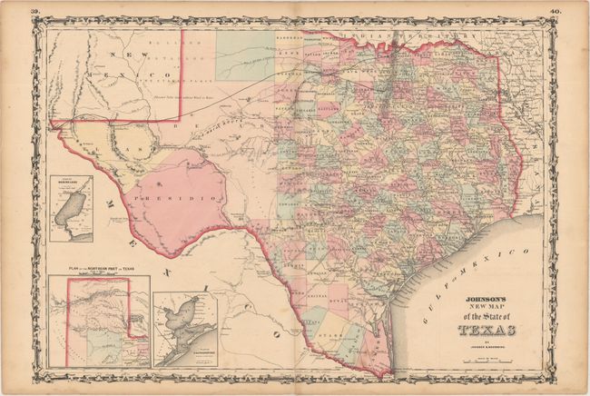
MapMaker: |
Johnson & Browning
|
|
| |
| |
Subject: |
Texas |
|
| |
Period/Size: |
1861 / 17.0" x 24.1" (43.2 x 61.3 cm)
|
|
| |
Color: |
Colored
|
|
| |
Condition: |
(B+) Original color with light toning and soiling. There is an archivally repaired centerfold separation that enters less than 2" into image at bottom, and faint damp stains along the bottom edge of the sheet, not entering image. (condition help) |
|
| |
Source: |
Illustrated Family Atlas of the World |
|
| |
References: |
Day #1416. |
|
| |
|
|
| Sales Information |
| |
| |
Price: |
|
|
| |
| |
Offered by: |
Old World Auctions |
|
| |
Catalog: |
Auction No. 161 - Antique Maps, Charts, Atlases & Globes (9343) |
|
| |
Lot/Item #: |
362 |
|
| |
| |
Date: |
02/2017
|
|
| |
| |
|