Title:
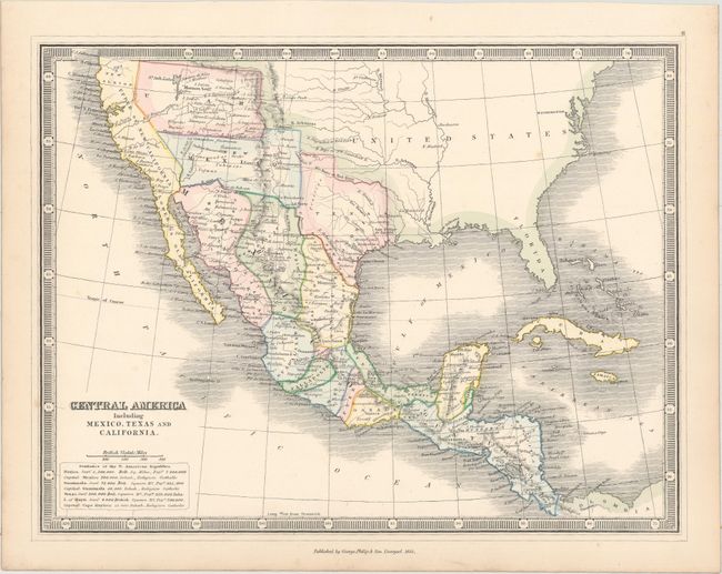
“Central America Including Mexico, Texas and California”
Map Maker:
George Philip [& Son]
This uncommon map depicts some interesting boundar... (full text available to subscribers)
| Item Detail |
| |
| |
MapMaker: |
George Philip [& Son]
|
|
| |
| |
Subject: |
United States, Mexico & Central America |
|
| |
Period/Size: |
1852 / 8.9" x 11.7" (22.6 x 29.8 cm)
|
|
| |
Color: |
Colored
|
|
| |
Condition: |
(A) Original color with minor toning along the edges of the sheet. (condition help) |
|
| |
Source: |
Library Atlas of Ancient and Modern Geography |
|
| |
References: |
|
|
| |
|
|
| Sales Information |
| |
| |
Price: |
|
|
| |
| |
Offered by: |
Old World Auctions |
|
| |
Catalog: |
Auction No. 161 - Antique Maps, Charts, Atlases & Globes (9343) |
|
| |
Lot/Item #: |
381 |
|
| |
| |
Date: |
02/2017
|
|
| |
| |
|
Antique Maps - Valuation and Pricing, Descriptions, Resources |
|
Home |
Information |
Search |
Register |
Contact Us |
Site Map
Americana Exchange, Inc. © 1999 - 2024 Americana Exchange, Inc.. All rights reserved.
OldMaps.com, the OldMaps.com logo and
AMPR are service marks or registered service marks of Americana Exchange, Inc..
|