Title:
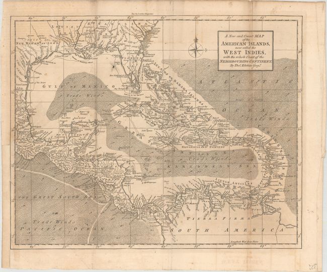
“A New and Correct Map of the American Islands, Now Called the West Indies, with the Whole Coast of the Neighbouring Continent”
Map Maker:
Thomas Kitchin
A finely engraved map of the Caribbean extending t... (full text available to subscribers)
| Item Detail |
| |
| |
MapMaker: |
Thomas Kitchin
|
|
| |
| |
Subject: |
Gulf of Mexico & Caribbean |
|
| |
Period/Size: |
1762 / 11.2" x 13.9" (28.5 x 35.3 cm)
|
|
| |
Color: |
Black & White
|
|
| |
Condition: |
(B) Issued folding with occasional light toning and offsetting. A 2" binding tear at left has been repaired with archival tape and several tiny splits at fold intersections have been repaired on verso with old paper. The binding trim at lower left has b (condition help) |
|
| |
Source: |
London Magazine |
|
| |
References: |
Jolly #LOND-216; Sellers & Van Ee #1692. |
|
| |
|
|
| Sales Information |
| |
| |
Price: |
|
|
| |
| |
Offered by: |
Old World Auctions |
|
| |
Catalog: |
Auction No. 161 - Antique Maps, Charts, Atlases & Globes (9343) |
|
| |
Lot/Item #: |
420 |
|
| |
| |
Date: |
02/2017
|
|
| |
| |
|
Antique Maps - Valuation and Pricing, Descriptions, Resources |
|
Home |
Information |
Search |
Register |
Contact Us |
Site Map
Americana Exchange, Inc. © 1999 - 2024 Americana Exchange, Inc.. All rights reserved.
OldMaps.com, the OldMaps.com logo and
AMPR are service marks or registered service marks of Americana Exchange, Inc..
|