Title:
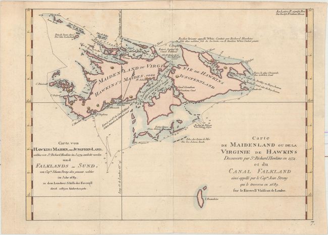
“Carte de Maidenland ou de la Virginie de Hawkins Decouverte par Sr. Richard Hawkins en 1574. et du Canal Falkland... / Carte von Hawkins Maiden, oder Jungfern-Land, Welches von Sr. Richard Hawkins im J. 1574. entdeckt Worden un Falklands-Sund...”
Map Maker:
John Hawkesworth
This striking chart of the Falkland Islands shows ... (full text available to subscribers)
| Item Detail |
| |
| |
MapMaker: |
John Hawkesworth
|
|
| |
| |
Subject: |
Falkland Islands |
|
| |
Period/Size: |
1774 / 8.6" x 11.6" (21.9 x 29.5 cm)
|
|
| |
Color: |
Colored
|
|
| |
Condition: |
(B+) A nice impression on watermarked paper. There is minor foxing and a fold separation confined to the bottom left blank margin that has been closed with archival materials. (condition help) |
|
| |
Source: |
Cartes et Figures des Voyages... |
|
| |
References: |
|
|
| |
|
|
| Sales Information |
| |
| |
Price: |
|
|
| |
| |
Offered by: |
Old World Auctions |
|
| |
Catalog: |
Auction No. 161 - Antique Maps, Charts, Atlases & Globes (9343) |
|
| |
Lot/Item #: |
478 |
|
| |
| |
Date: |
02/2017
|
|
| |
| |
|
Antique Maps - Valuation and Pricing, Descriptions, Resources |
|
Home |
Information |
Search |
Register |
Contact Us |
Site Map
Americana Exchange, Inc. © 1999 - 2024 Americana Exchange, Inc.. All rights reserved.
OldMaps.com, the OldMaps.com logo and
AMPR are service marks or registered service marks of Americana Exchange, Inc..
|