Title:
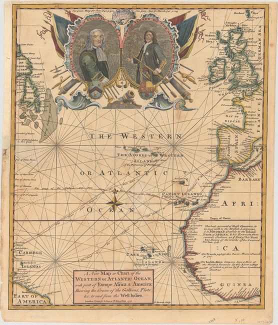
“A New Map or Chart of the Western or Atlantic Ocean, with Part of Europe Africa & America: Shewing the Course of the Galleons, Flota &c. to and from the West Indies”
Map Maker:
Emanuel Bowen
This handsome map of the Atlantic illustrates the ... (full text available to subscribers)
| Item Detail |
| |
| |
MapMaker: |
Emanuel Bowen
|
|
| |
| |
Subject: |
North Atlantic |
|
| |
Period/Size: |
1740 / 13.8" x 11.7" (35.1 x 29.8 cm)
|
|
| |
Color: |
Colored
|
|
| |
Condition: |
(B) Issued folding on watermarked paper with a small hole in the ocean adjacent to the compass rose that has been repaired on verso with old paper. Two minor edge tears at left and right have also been repaired with archival material on verso. There is (condition help) |
|
| |
Source: |
Gentleman's Magazine |
|
| |
References: |
Jolly #GENT-14. |
|
| |
|
|
| Sales Information |
| |
| |
Price: |
|
|
| |
| |
Offered by: |
Old World Auctions |
|
| |
Catalog: |
Auction No. 161 - Antique Maps, Charts, Atlases & Globes (9343) |
|
| |
Lot/Item #: |
481 |
|
| |
| |
Date: |
02/2017
|
|
| |
| |
|
Antique Maps - Valuation and Pricing, Descriptions, Resources |
|
Home |
Information |
Search |
Register |
Contact Us |
Site Map
Americana Exchange, Inc. © 1999 - 2024 Americana Exchange, Inc.. All rights reserved.
OldMaps.com, the OldMaps.com logo and
AMPR are service marks or registered service marks of Americana Exchange, Inc..
|